
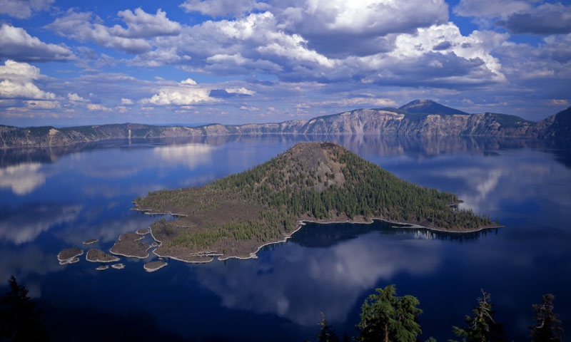


When Mt. Mazama was virtually decapitated over 7,700 years ago, the volcanic eruption that caused it also spread lava and ash over much of the greater Crater Lake area. The total affected area extended as far south as central Nevada and as far north as southern British Columbia. In comparison to Mount St. Helens that erupted on May 18, 1980, the eruption of Mt. Mazama produced 150 times more volcanic ash.
Some of the other unusual geological formations created by the volcanic eruption include the Pumice Desert, The Pinnacles, Mount Scott, Union Peak, Crater Peak, and Timber Crater.
The thick layer of pumice and ash lying north of Mazama is the Pumice Desert. It is the result of the excessively porous ground and poor soil left behind by the volcanic eruption. This makes it extremely difficult for plants to grow here. The tall Pinnacles were formed by the continuing escape of hot gas for years after the eruption. As the hot gas moved upward to the surface, it slowly formed ash and pumice together in tall stacks. The years of erosion has removed much of this formation, but has left behind tall spires.
Mount Scott and the other Volcanic Peaks found in the area are all remnants of the violent, powerful eruption that formed the geological wonder that today is known as Crater Lake National Park.
