


- The 55-mile Three Sisters Loop is one of the most spectacular backpacking routes in Central Oregon.
- The 1.7 mile hike to the summit of Pilot Butte offers panoramic views of Bend, Cascade peaks, and high desert.
- The 8.7-mile Newberry Crater Trail takes you through a volcanic crater formed over 500,000 years ago.
Overview
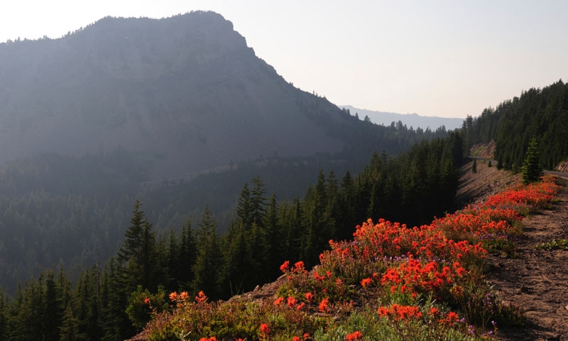
The area near Bend includes some of Central Oregon’s most beautiful scenery. With towering Ponderosa pines, sparkling rivers, crystal clear alpine lakes, and the spectacular Cascade Mountain Range, this area is truly a hiker’s paradise. There is an abundance of trails to explore, ranging from easy to strenuous. Whether you want to hike deep into the forest or climb to a high canyon rim for breathtaking views, Bend, Oregon hiking trails will never disappoint.
Pilot Butte - One of the most popular Bend, Oregon hikes is the one to the top of Pilot Butte – a cinder cone located on Bend’s east side. It offers panoramic views of Bend, high desert country, and several Cascade Peaks.
Trailhead: The Pilot Butte State Park parking lot - Located just off Greenwood Avenue (Highway 20), east of the Butte across from the headquarters of the Deschutes National Forest.
- Distance: 1.7 miles
- Average Time of Hike: 45 to 90 minutes
- Elevation Gain: 480 feet
- Difficulty: Easy
- Trail Type: Out and back
Benham Falls to Slough Meadow - This is a Bend hiking route that takes you along the Deschutes River through towering old-growth pines and lush meadows. The trail provides incredible views of Benham Falls, Broken Top, and South Sister.
Trailhead: Benham Falls Day Use Area – Take Hwy 97 south from Bend, turning right at the Lava Lands Visitor Center sign, then left on F.S. Road 9702 to the Benham Falls picnic area.
- Distance: 4.6 miles
- Average Time of Hike: 2 to 3 hours
- Elevation Gain: 100 feet
- Difficulty: Easy to moderate
- Trail Type: Out and back
Peter Skene Ogden National Scenic Trail - This beautiful 9.5 mile hike follows Paulina Creek as it meanders through towering pines and lush firs. You’ll see ancient lava flows and several waterfalls along the way. Part of the trail is in the Newberry National Volcanic Monument.
Trailhead: Peter Skene Ogden Trailhead – Take Hwy 97 south to Rd. 21; turn east and follow to the trailhead.
- Distance: 9.5 miles
- Average Time of Hike: 7 to 8 hours
- Elevation Gain: 2,050 feet
- Difficulty: Moderate
- Trail Type: One way
Newberry Crater Trail - Trek across the floor of the Newberry Crater just south of Bend, which was formed nearly half a million years ago by powerful volcanic activity. This is one of the most popular Bend, Oregon trails.
Trailhead: Crater Rim Trail near Cinder Hill. From Bend, take Highway 97 south to the entrance of the Newberry Volcanic National Monument.
- Distance: 8.7 miles
- Average Time of Hike: 5 to 7 hours
- Elevation Gain: 950 feet
- Difficulty: Moderate
- Trail Type: One way
Diamond Peak Loop - This scenic backpacking trail boasts some of Central Oregon’s most breathtaking scenery including Cascade peaks, alpine lakes, and lush forest.
Trailhead: Trapper Creek – Take Highway 97 south to Highway 58. Go west on Hwy 58, then turn right onto NF 5810 (Odell Lake W. Access Rd). Trailhead parking is on the right.
- Distance: 27.38 miles
- Average Time of Hike: 3 to 4 days
- Elevation Gain: 3,500 feet
- Difficulty: Moderate
- Trail Type: Loop
Three Sisters Loop - One of Central Oregon’s most spectacular backpacking routes, this loop boasts incredible views of the Three Sisters. Alpine meadows, sparkling lakes, and lava flows add to the incredible scenery found along this route.
Trailhead: Pole Creek – From Bend, take Highway 20 to Highway 242. Follow Highway 242 to Pole Creek Road. Go south on Pole Creek Road for about 11 miles.
- Distance: 55 miles
- Average Time of Hike: 5 to 6 days
- Elevation Gain: 8,200 feet
- Difficulty: Moderate
- Trail Type: Loop
Notes
When you’re hiking in Central Oregon, always be sure to bring plenty of water, especially on longer hikes. Weather conditions can change suddenly, so bring extra layers for cooler temperatures. Watch for bears and keep all food in tight containers. Watch and listen for rattlesnakes during the hot summer months in Central Oregon’s high desert country. Various permits are required in certain areas. These may include vehicle permits, recreation passes, and wilderness entry permits.
